OpenChangeDetectionMap is an open collaborative project to map changes on earth’s surface, detected using Geospatial Information Technologies and Big Data from Space and crowdsourced data. Any change, anywhere, by anyone, for everyone.
OpenChangeDetectionMap project’s goal is to democratize the access to earth observation-derived information to ensure that the impacts of human activities are monitored, evidence based decisions are made and sustainable and fair development becomes a reality for all.
The Map
The number of change detection datasets available in OpenChangeDetectionMap (OCDM) is unlimited: there are as many datasets as users need and the OCDM community can provide. There aren’t any internal restrictions on the data and platform used to generate the change detection information that is shown in the map.
Disclaimer: OCDM community has taken utmost care to develop the maps and information using freely available geospatial data with best possible accuracy. However, neither OCDM nor its contributors can accept any responsibility for errors, omissions or inconsistencies. If a problem of any nature is found, please send us your feedback at info@openchangedetectionmap.org
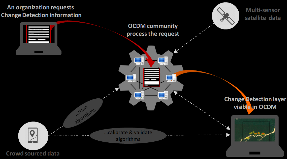
Why OCDM?
If OpenStreetMap community is succesfully mapping the world, OCDM community may succesfully map changes in the world. By enhancing collaboration between the Big Earth Data community and citizens, OCDM aims to solve two problems:
- The lack of awareness, technical knowledge and/or resources to exploit Earth Obrsevation data.
- The lack of ground truth data to train, calibrate and validate change detection algorithms.
How it works?: The concept